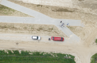
Flight missions over levees near Annopol
On 15-16 May, 2017, Institute of Meteorology and Water Management team in collaboration with MSP performed series of flight missions over Dolina Świeciechowska test area, near Annopol. The UAV platform called “Hawk Moth”, which is equipped with an ultra-light laser scanner YellowScan Surveyor and a digital camera Sony Alpha 6000, was used. Within two days, point clouds and RGB images were acquired for 6 km of levees section. Obtained data will be processed into DTM and orthomosaic, which will be imported to SAFEDAM IT system.


