SAFEDAM
Advanced technologies in the prevention of flood hazard

The Faculty of Geodesy and Cartography of Warsaw University of Technology on behalf of the consortium implementing the project cordially invites you to the seminar ending the project: SAFEDAM - Advanced technologies in the prevention of flood hazard.
The seminar will start on May 21, 2020 at 14:00 on the platform at:
https://conf.astripolska.net/join-conference/woj-7nc-fzy
The meeting platform does not require any software installation - participation requires only a internet browser.
Participation in the seminar is for free. Seminar language is Polish
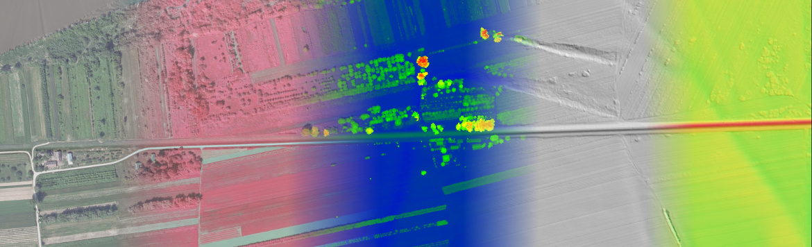
On March 17, 2020, MSP and the Warsaw University of Technology, Faculty of Geodesy and Cartography carried out the first BVLOS (Beyond Visual Line of Sight) flight in Poland with a laser scanner mounted on UAV platform. The Neo3 by MSP platform obtained an appropriate entry in the register of civil aircrafts and the mission received the approval of the President of the Civil Aviation Authority.
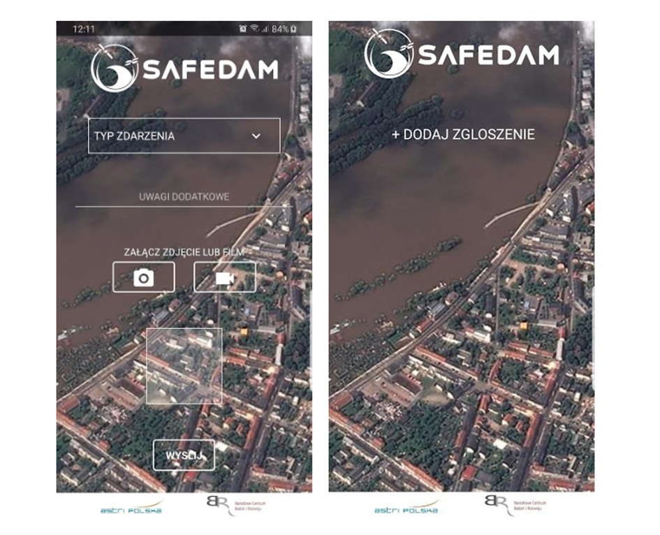
The Geopartycypacja application, which was developed as part of the SAFEDAM project, is now available in Google Play. The application allows you to send notifications about events related to levees (damage, cracks, overflow, etc.).
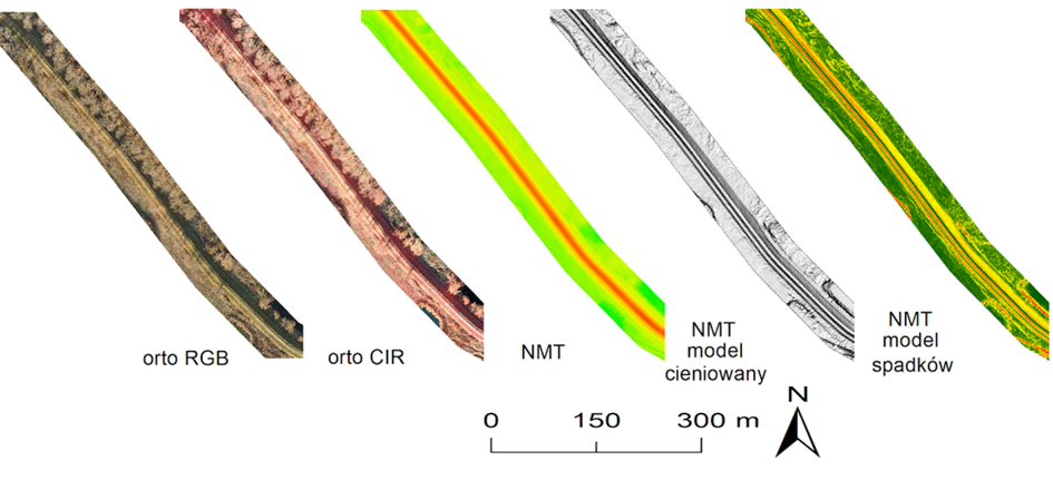
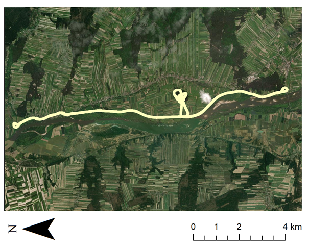
On 18 October and 5 December 2019 flights missions were conducted over two test areas: the Płock area and the new area in the project - the Odra area. The flights from the unmanned prevention platform - the NEO3 fixed-wing - included: images in real colours (RGB), near-infrared (CIR) and airborne laser scanning.
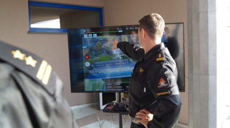
On 25-26 October and 7-8 November 2019 two training courses were held at the Central School of the State Fire Service in Częstochowa under the title "Use of the SAFEDAM intervention platform in rescue operations during flood hazards". The training was the result of participation of the Central School in the SAFEDAM project consortium.
At the end of May, heavy rains in southern Poland increased the risk of flooding.
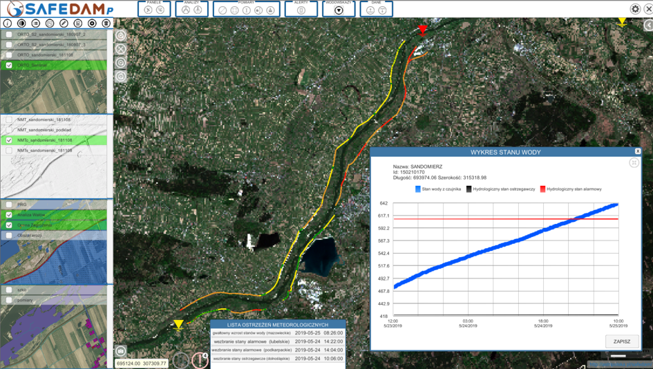
The aim of the SAFEDAM project is the creation of system for levees monitoring using a non-invasive, unmanned aerial platform, which scans from low-altitude, and optical, radar satellite and aerial imagery. For this purpose innovative, photogrammetry and remote sensing technologies will be used. Endangered areas, detected preliminarily by images will be measured by non-invasive, flying measuring platform with centimeter accuracy using 3D measurement technique. The methodology of system application, training program and proposals of procedures related to the management of flood risk will be also prepared.
A comprehensive system will enable the collection, automatic data analysis and 3D visualization for hydrological services and crisis management professionals. The system will also allow society for geoparticipation in monitoring the levees. Its implementation will ensure effective management of flood risk. System will complement the already implemented projects of flood protection.
The project is financed by National Centre for Research and Development in Defense, Security Programme. It is carried out by the consortium of Warsaw University of Technology Faculty of Geodesy and Cartography, Institute of Meteorology and Water Management, MSP Marcin Szender, Astri Polska Sp. o.o., Central School of the State Fire Service in Częstochowa.
Project is financed by National Centre for Research and Development in Defense, Security Programme