Summary of half of the first stage in SAFEDAM project
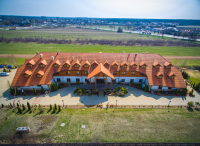
On the 30.06-1.07 2016 training and working meeting of the SAFDAM project members took place. The meeting was organised in Folwark Klepisko in Nieporęt. The aim of the meeting was to increase of the awareness of the interdisciplinarity in the project. The interdisciplinarity can be first of all noticed in the usage of various geospatial data. Furthermore, during the meeting the working tasks within particular groups were discussed in order to fulfil the tasks of the scientific stage properly.
Therefore, the basics and the possibilities of the usage of airborne images were discussed. Additionally, possibilities of using the satellite imagery in the project, databases structures, methodology ideas of the flood hazard mapping and comparison of the data acquired in different terms were presented. During the meeting the state of ongoing scientific tasks was reported and the unmanned aerial vehicles were presented by the MSP workers. The meeting was also a good opportunity to integrate the interdisciplinary scientific teams.


