The first BVLOS flight with laser scanner
On March 17, 2020, MSP and the Warsaw University of Technology, Faculty of Geodesy and Cartography carried out the first BVLOS (Beyond Visual Line of Sight) flight in Poland with a laser scanner mounted on UAV platform. The Neo3 by MSP platform obtained an appropriate entry in the register of civil aircrafts and the mission received the approval of the President of the Civil Aviation Authority.
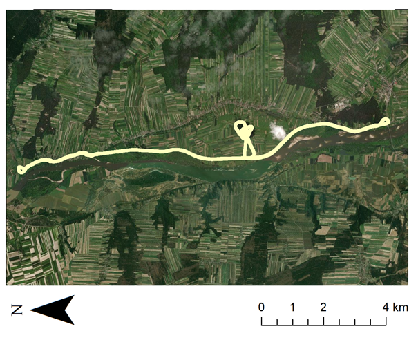
Within SAFEDAM project (“Advanced technologies in the prevention of flood hazard”) 6 kilometers of dykes were monitored, however, flight mission covered nearly 15 kilometers of terrain along the river from Józefów nad Wisła to Annopol. The entire trajectory of the flight reached nearly 35 kilometers. The density of the point cloud collected from altitude of 120 meters was about 6 points per square meter, and the resulting accuracy of digital terrain models reached 4 cm, which was verified with ground GNSS measurements. The platform also collected visible and near-infrared images. Data acquisition took about 40 minutes. In addition to another analysis of the accuracy of digital terrain models, study also investigated how greater distance from the virtual reference station affects the accuracy of the trajectory, and verified the density of the geodesic control points for linear objects which are much more difficult than for block flight missions. All products of photogrammetric and remote sensing data processing will be included in IT system for levee monitoring developed in SAFEDAM project.
